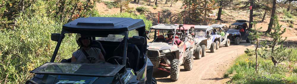
2025 Rides

Additional rides may be added at a later date. This will depend on registration.
Four-Wheel Drive is recommended and a minimum of 400cc.
We will be staging daily from the Antelope Valley Fire Station located at 1166 Larson Lane in Coleville.
Please note that rides with 5 or fewer registered vehicles may be combined with other rides.
Also note that unless otherwise stated in the ride description, you will need to provide your own sack lunch, water, soda, gas, etc. while on the rides.
Mileage indicated is round trip and approximate. Be prepared with water and extra fuel. It is your responsibility!
Flags and helmets are required on all ATV's and UTV's. Safety glasses or goggles are recommended.
Difficulty Definitions
Intermediate: These rides generally include some road and ATV trail portions with some steep, rough, or challenging trails. A ride may also be intermediate in nature due to its length.
Advanced: These rides will generally include portions that are steep, rough, and otherwise difficult to maneuver. In some cases, rides are listed as advanced because of the length of the ride. NOT FOR BEGINNING RIDERS!
We do not currently offer any beginner rides. All rides are intermediate and advanced.
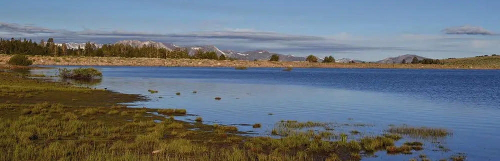
#1 Lobdell Lake
Difficulty: Intermediate to Advanced
Distance: 55 miles
Trail Head: Antelope Valley Fire Station
Capacity: 20 Vehicles
OHV Type: ATV & UTV
Maximum Elevation: 9,600 ft
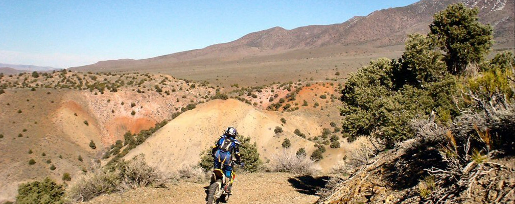
This ride leaves from the trail head and follows a dirt road high above the West Walker River. The views become more spectacular with each mile traveled. The first stop is at the scenic Lobdell Lake, at elevation 9,239 ft. After this stop, we will continue along a ridge line with some of the best views of the Sierra Nevada’s. The trail then becomes narrower, rocky, and steep. Ride the “roller coaster” along Jackass Creek with another stop at Desert Creek. Then, back on the trail headed for home.
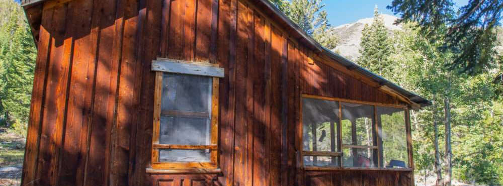
#2 Quaint Cabin
Difficulty: Intermediate
Distance: 55 miles
Trail Head: Antelope Valley Fire Station
Capacity: 20 Vehicles
OHV Type: ATV & UTV
Maximum Elevation: 8,271 ft (optional 9,100 ft)
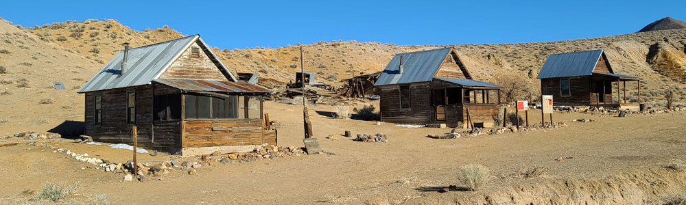
Leave from the Fire Station. Travel along a dirt trail stopping along the way to see an old mine, vistas of the Eastern Sierra, then out along a canyon and ridges. Ride along an old windy trail amongst the free-range cattle. Keep a sharp eye out for deer and other wildlife. Then we ride to the old Nugent cabin (elev. 8,271 ft) as our destination. A short-ways past our stop is the original cabin, use your imagination to take yourself back in time and picture the activities that once took place here. Make sure you see the old “river water” shower!
#3 Desert Creek
Difficulty: Intermediate
Distance: 55 miles
Trail Head: Antelope Valley Fire Station
Capacity: 20 Vehicles
OHV Type: ATV & UTV
Maximum Elevation: 7,250 ft
This ride leaves directly from the Fire Station. The stops along the way include an old mine and a rest along a beautiful creek. This ride includes both forest and high desert riding. You will cross streams as we head to the picturesque town of Wellington in Smith Valley, Nevada. Lunch stop will be at quaint restaurant where you can purchase lunch or bring your own lunch and eat outside. The ride continues along the West Walker River with views of the Antelope Valley from the north.
#6 Indian Valley Back for 2025 !
Difficulty: Advanced
Distance: 40 miles
Trail Head: Antelope Valley Fire Station
Capacity: 20 Vehicles
OHV Type: ATV & UTV
Maximum Elevation: 8,500 ft
This is an advanced ride that requires technical skills. Beginners are NOT allowed on this ride. It contains narrow trail and rock climbing; scratches may occur along the trail. We reserve the right to exclude anyone we feel is not capable of doing this ride. 4x4 is required, 2-wheel drive is not allowed.
Come explore an old mine road up to the Lilly Mine including some rock climbing. Then onto Indian Valley and Salmon Valley before another narrow, slow going trail. Reach an elevation of ~8400 feet before heading back down for more. This is an Advanced ride. Some scratches and scrapes may occur along the way. Pack your own lunch, water and supplies.
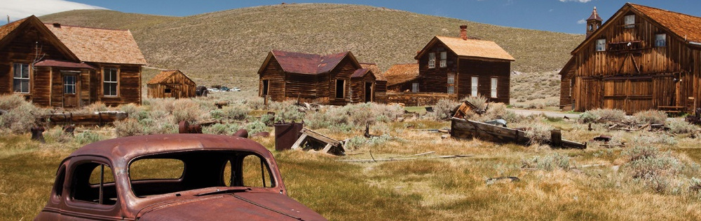
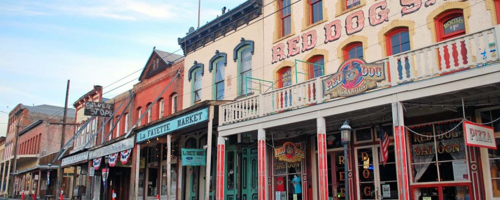
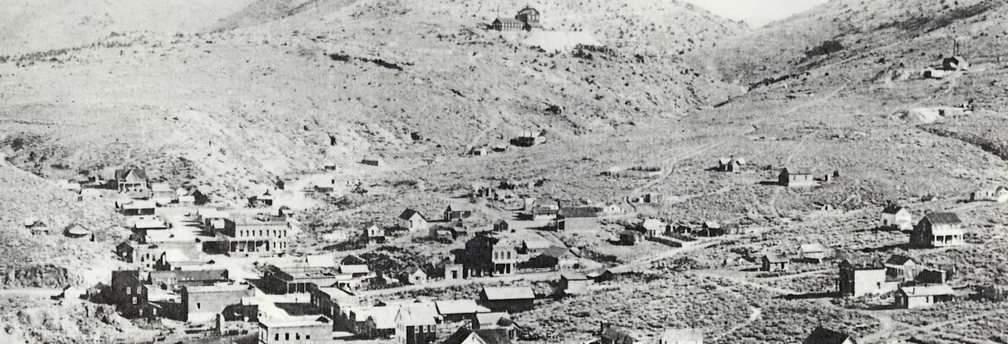
#7 Bodie
Difficulty: Intermediate
Distance: 40 miles
Trail Head: North of Bridgeport (You must transport your UTV 40 miles from the Antelope Valley Fire Station)
Capacity: 20 Vehicles
OHV Type: ATV & UTV
Maximum Elevation: 9,300 ft
Please note: A park entry fee of $8 per adult and $5 per child is required on this ride. Payment is due at park upon entry and is your responsibility. You will have 2-3 hours to walk around and explore the old town of Bodie.
This ride requires all ATV's/UTV's to be transported (your responsibility) 40 miles to a trailhead north of Bridgeport. We will caravan from the Antelope Valley Fire Station and head south along highway 395 to our staging area. This ride starts out at 6,500 ft elevation. We follow an old road out east of Bridgeport and then turn south, attaining an elevation of over 9,300 ft. Then we drop down into the Bodie Historic Park. Make sure to get a tour of the old stamping mill. This is HIGHLY recommended! And don't forget to bring your camera. Bring your lunch as there are no services inside Bodie. Then we mount up and head towards home.
On the drive back, stop in Bridgeport for an ice cream at Jolly Kone and discover all that Bridgeport has to offer!
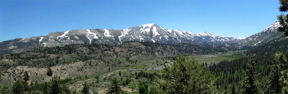
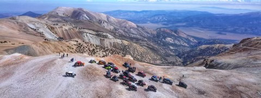
#14 Mount Patterson
Difficulty: Advanced
Distance: 70 miles
Trail Head: Antelope Valley Fire Station
Capacity: 20 Vehicles
OHV Type: ATV & UTV
Maximum Elevation: 11,673 ft
Spare tires required. Four-wheel drive required. Two-wheel drive and sport quads not allowed. We reserve the right to exclude anyone we feel is not capable of doing this ride.
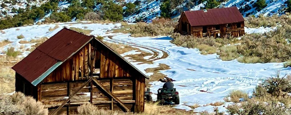
This ride leaves from the Antelope Valley Fire Station along a dirt road high above the West Walker River. The views become more spectacular with each mile traveled. The first stop is at the scenic Lobdell Lake, elevation 9,239 ft. After this stop, we continue east and start our climb to the top of Mount Patterson (elev. 11,673 ft). After climbing through trees we hit the steep switchbacks and arrive in what most people call “moonscape”. We will stop at the top of Mt. Patterson for picture taking. From here, we will head southeast and descend the “moonscape” for towards Belfort, an old mining area with a couple of old buildings. We finish up by heading east then south, going around the mountain on our way back home.
#15 Tower Back for 2025 !
Difficulty: Intermediate
Distance: 35 miles
Trail Head: Topaz Lake area, ~15 mile drive
Capacity: 20 Vehicles
OHV Type: ATV & UTV
Maximum Elevation: 8,500 ft
This ride requires all UTVs to be transported (your responsibility) north just past Topaz Lake, ~15 miles. We will caravan from the Antelope Valley Fire Station on highway 395 to our staging area.
This is a very easy and comfortable ride. We will travel on dirt roads and trails with some rocky areas along the ways. This ride starts out at ~5500 feet and climbs on a switchback road (wide) to 7300’ then to a maximum of 8500’. The views westward are to die for so bring the camera. Bring your lunch as we will stop along the way to eat.
#16 Rattlesnake Back for 2025 !
Difficulty: Very Advanced
Distance: 140 miles
Trail Head: Antelope Valley Fire Station
Capacity: 15 Vehicles
OHV Type: ATV & UTV
Maximum Elevation: 11,673 ft
We reserve the right to exclude anyone we feel is not capable of doing this ride.
Join us on the “Rattlesnake” and ride 140 miles in a single day! This is a shortened version of the Hawthorne Overnight ride.
This ride takes off from the Antelope Valley Fire Station. Travel ~4 miles on a paved road to a dirt road. The pace is picked up as we head east into the Sweetwater Mountains. We will pass by the Rockland Mine and down a beautiful red rock canyon out towards the East Walker River. After crossing the East Walker River, we will once again climb into the mountains. This trail follows the base of the mountains as we move south then west back to the West Walker River. Back along the West Walker River and back into the Sweetwater Mountains. We will climb fast and steady to the top of Mount Patterson (11,672’ elevation) then down the west face towards Lobdell Lake and home.
Note that extra gas is required on this trip! Bring your own fuel, food, drinks and repair kits.
#17 Virginia City Overnight
Difficulty: Intermediate to Advanced
Distance: 85 miles per day, 2 days, fuel stop and overnight stay
Trail Head: Antelope Valley Fire Station
Capacity: 12 Vehicles
OHV Type: UTV only
Maximum Elevation: 9,200 ft
Spare tires and extra fuel are required. Four-wheel drive UTVs only. Two-wheel drive and quads not allowed. We reserve the right to exclude anyone we feel is not capable of doing this ride.
This is a long ride with an overnight stay in a hotel in Virginia City. You are responsible for the cost of your own room and meals. We will have a discounted block of rooms at a local hotel. After you have signed up for this ride, we will notify you to contact the hotel and book your own reservation.
This 170 mile two-day trip will create a lifetime of memories!
Note: This ride is available only once during the entire Jamboree, leaving on Tuesday, and returning on Wednesday. Due to the popularity of this ride, participation will be on a first come, first served basis. Only 12 vehicles are allowed on this ride. If you participate in this ride, you will need to arrive in Coleville on Monday and be prepared to leave early on Tuesday. Breakfast will not be provided on this day.
This ride takes off from the Antelope Valley Fire Station. We head north to Wellington then into and through the Pine Nut Mountains. We will ride over various ridges and through grass covered valleys towards the Carson River. After crossing the river and Highway 50, we will climb into the mountains towards our overnight destination of Virginia City, Nevada.
We will spend the night at a hotel in Virginia City. To get the best deal, we had to pay for the hotel rooms UP FRONT, so you will be asked to pay for your room with your registration.
After breakfast, we will gas up at a local gas station for the ride towards home. Upon leaving Virginia City, we will take a somewhat different route than the previous day and eventually return to the Fire Station.
#18 Hawthorne Overnight Back for 2025 !
Difficulty: Advanced
Distance: 100 miles per day, 2 days, fuel stop and overnight stay
Trail Head: Antelope Valley Fire Station
Capacity: 12 Vehicles
OHV Type: UTV only
Maximum Elevation: 11,673 ft
Spare tires and extra fuel are required. Four-wheel drive UTVs only. Two-wheel drive and quads not allowed. We reserve the right to exclude anyone we feel is not capable of doing this ride.
This is a very long ride with an overnight stay in a hotel in Hawthorne.
This 200 mile two-day trip will create a lifetime of memories! This ride is STRICTLY for Advanced riders only.
Note: This ride is available only once during the entire Jamboree, leaving on Tuesday, and returning on Wednesday. Due to the popularity of this ride, participation will be on a first come, first served basis. Only 12 vehicles are allowed on this ride. If you participate in this ride, you will need to arrive in Coleville on Monday and be prepared to leave early on Tuesday from the Fire Station. Sorry, breakfast will not be provided on this day.
This ride takes off from the Antelope Valley Fire Station. The pace is quick as we head east into and through the Sweetwater Mountains. We will pass by the Rockland Mine and down a beautiful red rock canyon out towards the East Walker River. After crossing the river, we will once again climb into the mountains. This trail crosses the Wassuk Range as we move east and closer to our overnight destination of Hawthorne, Nevada.
We will spend the night at a hotel in Hawthorne. You are responsible for your own overnight accommodations. We will let you know which hotel the group is staying at, and you will call to book your own reservation.
After eating breakfast, we will gas up at a local gas station for the ride towards home. Upon leaving Hawthorne, we head over Lucky Boy Pass, then ride along a ridge as we head west. Back along the West Walker River and back into the Sweetwater Mountains. We will climb fast and steady to the top of Mount Patterson (11,673’ elevation) then down the west face towards Lobdell Lake and home.
Note that extra gas is required as we could approach 120 miles each day! Bring your own fuel, food, drinks and repair kits.
#21 Pine Nut Mountains
Difficulty: Advanced
Distance: 115 miles
Trail Head: Antelope Valley Fire Station
Capacity: 20 Vehicles
OHV Type: ATV & UTV
Maximum Elevation: 8,800 ft
We reserve the right to exclude anyone we feel is not capable of doing this ride. 4x4 is required, 2-wheel drive and Sport Quads are not allowed!
This ride leaves from the Antelope Valley Fire Station and proceeds to the small town of Wellington Nevada. We wind our way through Smith Valley until we start climbing thru Ricky Canyon. We reach a high point of around 9,000 feet.
We descend going through mountain tops each with spectacular views and through valleys with Aspens and small creeks. This ride has a bit of everything but most importantly it has beautiful views and vistas galore.
Spectacular views and wildlife abounds. Bring your camera. Bring your lunch as we will stop along the way to eat.
#25 Wheeler Flat
Difficulty: Advanced
Distance: 110 miles
Trail Head: Antelope Valley Fire Station
Capacity: 20 Vehicles
OHV Type: ATV & UTV
Maximum Elevation: 8,450 ft
Beginners and Intermediates are NOT allowed on this ride. This ride can be 8+ hours long and is a fast-paced ride! If you are a slow rider, this is not the ride for you. You are responsible for carrying your own water and extra fuel. We reserve the right to exclude anyone we feel is not capable of doing this ride. 4x4 is required, 2-wheel drive and Sport Quads are not allowed.
This ride takes off from the Antelope Valley Fire Department. At around 110 miles, this ride will have it all, historic ghost towns, pioneer cemeteries, mining sites, amazing geological features, winding trails, water crossings, and thousands of feet in elevation change. Despite the name, this ride is not flat. It gets it's name from an old ghost town along the way.
First we cross the Sweetwater Mountains, then wind our way through various sandy valleys and ridges. If the group isn't too large, we'll stop at the Rockland Mine that has a year-round ice flow inside (you can look but not safe to enter). Then we'll continue east through a beautiful red rock canyon to Wheeler Flat before turning and heading west to the Pine Grove ghost town. We'll visit a historical cemetery then proceed north towards Wilson Canyon. From there we head southwest through Desert Creek, maybe stop to view some old petroglyphs, then return home.
#26 Del Monte
Difficulty: Advanced
Distance: 90 miles
Trail Head: North of Bridgeport (You must transport your UTV 40 miles from the Antelope Valley Fire Station)
Capacity: 20 Vehicles
OHV Type: ATV & UTV
Maximum Elevation: 9,300 ft
Note this is a fast-paced ride. If you are a slow rider, this is not the ride for you. You are responsible for carrying your own water and extra fuel. We reserve the right to exclude anyone we feel is not capable of doing this ride. 4x4 is required, 2-wheel drive and Sport Quads are not allowed.
This ride requires all ATVs/UTVs to be transported (your responsibility) 40 miles to a trailhead north of Bridgeport. We will caravan from the Antelope Valley Fire Station. We follow an old road, then turn south, attaining an elevation of over 9,300 ft. Then we drop down towards the Bodie Historic Park, but we do not stop. We continue north into Nevada, past the ghost town of Del Monte, and into the ghost town of Aurora, where we will have lunch. In the afternoon we will ride west to the old stamp mills of the Masonic ghost town, where we will take a break before heading back to the trailhead.
On the drive back, stop in Bridgeport for an ice cream at Jolly Kone and discover all that Bridgeport has to offer!